Title: Advanced topics in Spaceborne SAR Interferometry
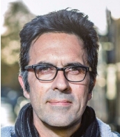
Speaker: Prof. Dr. Ir. Ramon Hanssen
Affiliation: Delft University of Technology
Abstract: With the increased availability and accessibility of satellite SAR data, data processing software tools, and even 'analysis-ready' results, InSAR seems to become a commodity. In this tutorial, we will critically evaluate seemingly basic principles and standard practices, address some of the shortcuts that were made in the first algorithm implementations, and propose advanced level methodology. This will also include new concepts, coordinate systems and terminology. The tutorial will consist of five chapters, followed by an open discussion with the participants.
Chapter 1. The current state of the art in InSAR parameter estimation.
Over a period of three decades, several methods for InSAR parameter estimation have been developed, that currently exist next to each other, and gave rise to the "tripartite nature of causality in InSAR results" The question is which methodology to use, and how this is influenced by the application. In relation to the quality of the produced 'InSAR information product', we will discuss double-A and triple-A products, and the relevance of the distinction. The chapter concludes with the proposition that in order to produce an 'optimal' result, we first need to define optimality.
Chapter 2. InSAR advanced geometric analysis
Starting from orbital mechanics and the SAR imaging system, we will focus on the geometry of the displacement vector, and the concepts of projection and decomposition. We argue that it is not necessary to limit ourselves to decomposition in the east-up plane, but that there are alternatives to get to three-dimensional displacement vector estimation.
Chapter 3. InSAR parameterization and advanced physical parameterization
InSAR parameterization has hardly changed since the introduction of satellite InSAR. We are still looking at the conventional ‘velocity maps’ whereas this parameterization is perhaps the least obvious for InSAR deformation monitoring. We focus on alternative parameterizations, that lead to better interpretable information. We also discuss batch and recursive parameter estimation techniques.
Chapter 4. InSAR dynamic parameter estimation, and why phase unwrapping is wrong
We discuss that the fundamental philosophy for phase ambiguity estimation, better known as phase unwrapping, is heuristic and flawed. We can do much better, and for this we need to distinguish explicit and implicit unwrapping. Contextual information is key in this respect. We demonstrate the concept of the fly-curtain to determine the likelihood of correct ambiguity estimation
Chapter 5. The InSAR stochastic model and quality estimation
An assessment of the quality of InSAR estimates using ‘coherence’ as main concept is sub-optimal. It is important to acknowledge that quality is time variable as well as location variable. We show how we can make use of information hidden within the SAR data to derive an a priori stochastic model, that can be used to improve the parameter estimates beamformer.
Biography:

Ramon Hanssen (MSc 1993; PhD 2001, cum laude) is Antoni van Leeuwenhoek professor in Geodesy and Satellite Earth Observation at Delft University of Technology (TU Delft). He studied aerospace engineering and geodetic engineering at Delft University of Technology, and worked as visiting scholar at Stuttgart University, the German Aerospace Center (DLR), and Stanford University (1997-1998) on a Fulbright research fellowship. His work centers around fundamental scientific and applied engineering problems in geodesy and earth observation. In particular, he pioneered the geodetic use of synthetic aperture radar interferometry (InSAR), as a high-precision technique to measure deformations of the earth’s surface and objects in the built environment. He is author of several patents, and his monograph on radar interferometry is the highest cited text book in the domain. His expertise domain should be placed in between the fields of electrical engineering and signal processing on one side, and geophysical-geotechnical applications on the other. The geodetic approach implies a focus on parameter estimation problems, quality control and error propagation, and testing theory. His interest ranges from deformation signals on wide scales, e.g., related to global warming, sea level variability and subsidence, to fine scales, such as the deformation of critical civil infrastructure. He did pioneering work on atmospheric water vapor mapping using radar interferometry. He received the Bomford Prize from the International Association of Geodesy, the Innovational Research Award from the Netherlands Organization for Scientific Research (NWO), and was appointed to the prestigious Antoni van Leeuwenhoek Chair at TU Delft in 2007. In 2007 he founded a spin-off company, SkyGeo, for the operational geodetic monitoring of assets, where he currently serves as Chief Science Officer. As a leading expert in his field, he has held visiting professorships at various universities and is a well know educator in professional training courses by ESA and IEEE.